Apr 2025 - May 2025
Redefining Pickup Accuracy at
India's Busiest Transit Hubs
52%
Reduction in
Cancellation rate
72%
Reduction in
Support tickets
44%
Improvement in
Avg. Pickup time

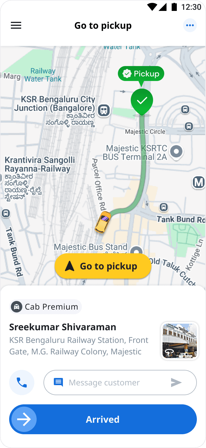
The driver app is a core mobility platform that enables professional drivers to accept ride requests, navigate to riders, complete trips, and earn income. It acts as the driver’s main tool for managing their day-to-day operations—covering trip assignments, navigation, rider communication, and earnings management.
This case study is different from most of my work — I wasn't handed this problem. I found it, built the case for it, and then led the design.
Overview
👀 From Observation to Opportunity
The experience at Bengaluru Railway Station stayed with me long after the ride. Three consecutive drivers had cancelled—not because they were unwilling to take the trip, but because they couldn’t confidently locate me in a crowded transit hub. Rather than treating it as an isolated incident, I wanted to understand whether this was a larger problem. Since pickup accuracy wasn’t an active roadmap initiative, I first needed to validate whether it was a meaningful opportunity worth pursuing.
I analyzed cancellation trends, pickup times, support tickets and order fulfilment data, and combined those insights with field research. The evidence confirmed that this wasn’t a one-off customer experience, but a systemic issue affecting drivers, customers and the business.
With enough qualitative and quantitative evidence, I built a strong problem statement, aligned stakeholders around the opportunity, and successfully moved the initiative onto the product roadmap.
🤝 Building Alignment Across Teams
Once the opportunity was validated, the next challenge wasn't designing the solution—it was building alignment across teams.
I brought together operational data, customer complaints, driver interviews and business metrics to create a compelling narrative around the problem. Instead of presenting Street View as a new feature, I positioned it as an opportunity to improve pickup accuracy, reduce cancellations and strengthen overall order fulfilment.
This shifted conversations from "Should we build this?" to "How can we make this work?" With cross-functional alignment across Product, Engineering and Operations, the initiative was prioritized and moved into development.
📈 Proving the Problem
To validate my hypothesis, I analyzed marketplace data across transit hubs. The evidence confirmed this wasn't an isolated customer experience.
23%
Transit hub
Cancellation
8.5 mins
Increase in avg.
Pickup time
40%
Increase in
Help Tickets
To better understand the problem spatially, I visualized the complete pickup journey by mapping where customers placed ride requests, where drivers actually navigated, and where cancellations occurred. This made it clear that the failure wasn’t random—it happened repeatedly at the last few meters of the pickup journey, where GPS accuracy dropped and visual context became critical.

Customer Booking Spot

Driver Arrival Point
The goal was clear:


Improve pickup
Setting out to solve
🧭 Let's first understand what actually happens during a pickup
The data showed where cancellations were happening, but it didn't explain why. To uncover the root cause, I mapped the end-to-end pickup journey—from the moment a customer booked a ride to the point where a cancellation occurred. While the journey highlighted potential friction points, I needed to validate them in the real world.

📊 Validating the Opportunity
3 Days
Research
4 Hubs
Transits
24
Drivers
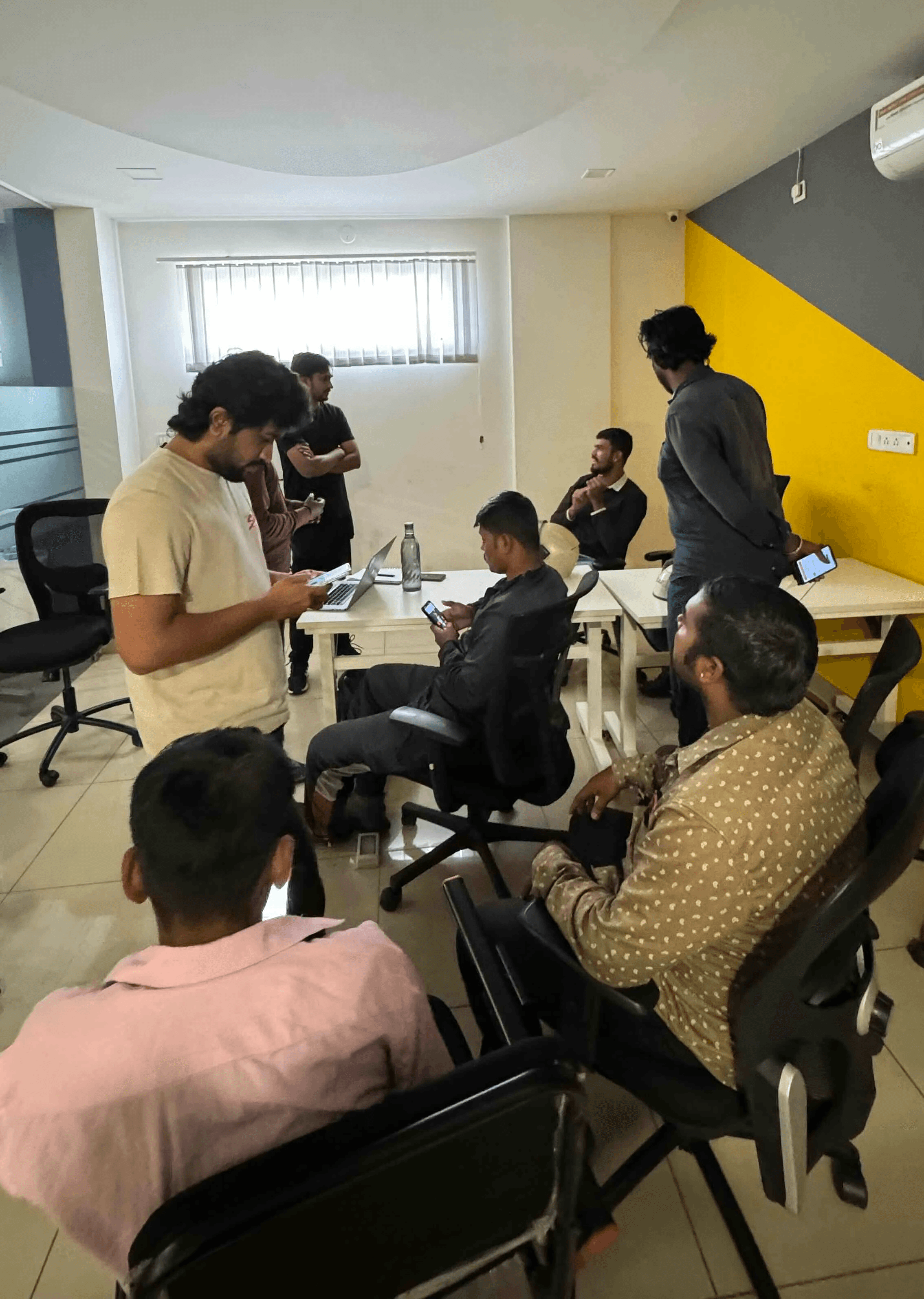
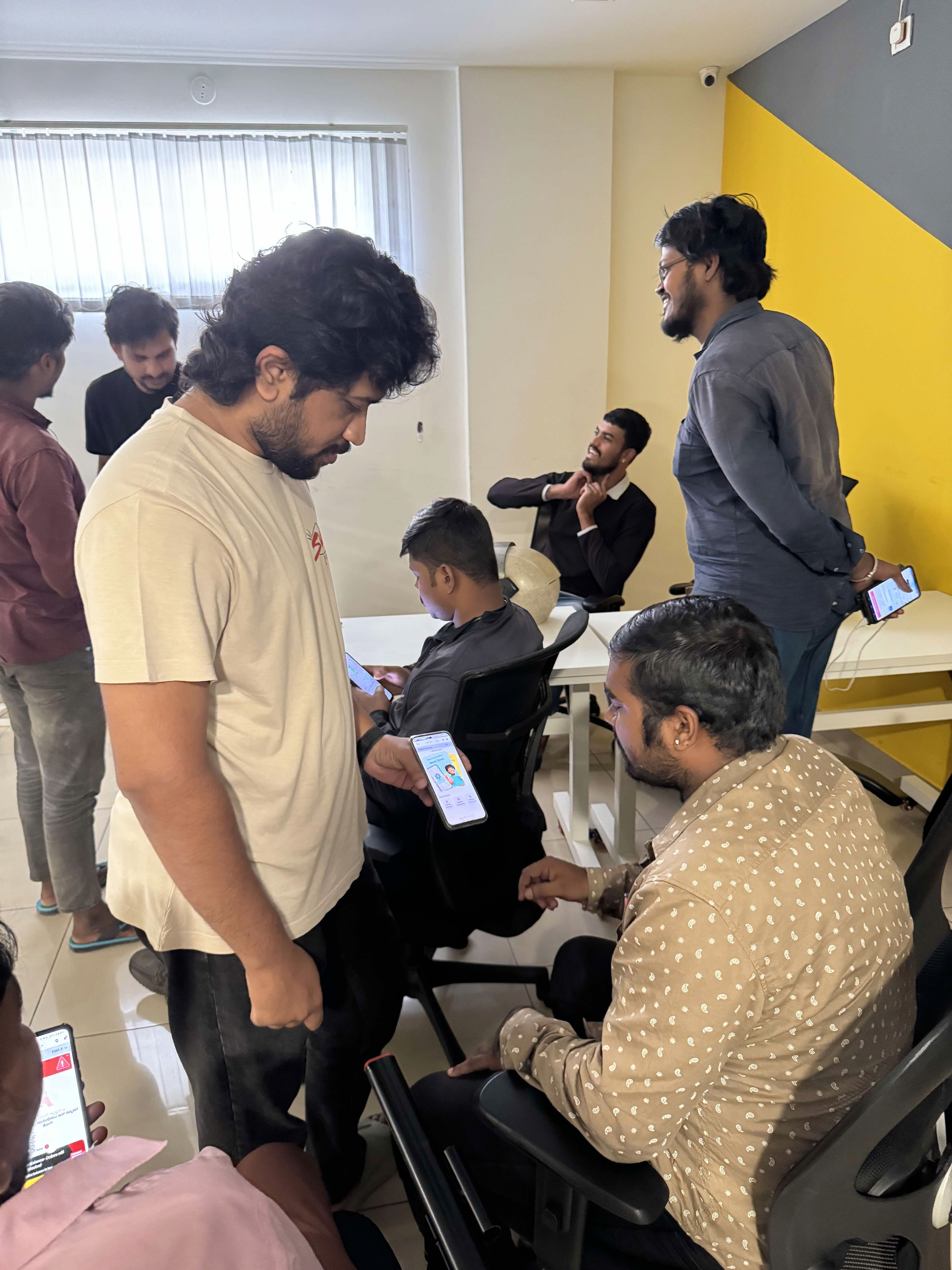
I spent three days shadowing drivers across major railway stations and airports, observing live pickups and interviewing drivers immediately after failed orders.
The research revealed that GPS wasn’t failing because navigation was inaccurate—it was failing because drivers lacked environmental context. Once inside complex transit hubs, maps could indicate the destination but couldn’t explain which gate, entrance or pickup lane the customer was actually waiting at.
One driver summed it up perfectly:
“Show me a photo of where to go — I’ll find them faster than any map can.”
Sangappa, Auto Driver
That insight became the foundation for the entire product strategy.
Product Thinking
💡 Reimagining the Pickup Experience
I reframed the problem not as a navigation issue, but as a context issue. The insight was simple yet powerful: seeing the location is more reliable than following it. That single insight sparked the hypothesis:
“If drivers can see the pickup point through real-world visuals, we can dramatically improve pickup accuracy.”
Before committing to a direction, I explored multiple concepts including pickup instruction cards, phone flash signals, and contextual street imagery.
Street View emerged as the strongest solution because it aligned with natural driver behavior, reduced guesswork, and worked even without customer intervention.
Solution
Introduce street view or image of pick-up location
This feature will view of the pick-up location directly in the app, helping drivers visually identify exactly where to meet passengers at busy or confusing places. It provides real-world context—such as nearby landmarks, building entrances, or special waiting zones—for greater accuracy and confidence during pickups.

✨ Creating a Product Vision
Rather than designing a solution exclusively for railway stations and airports, I deliberately thought beyond the immediate problem.
If visual context could improve pickup accuracy in transit hubs, it could become a scalable capability across every pickup journey on the platform.
This led to the concept of the Visual Pickup Experience—a new interaction model combining visual navigation, contextual information and communication to reduce ambiguity throughout the entire pickup journey.
This required more than UI tweaks — it called for a new design language built on three user needs that I have defined:
Confidence to arrive at the pickup location
For a driver, confidence doesn’t come from the map — it comes from certainty. In crowded transit hubs, every moment of hesitation—choosing the right gate or lane adds delays, and frustration.
Save time, stress and
fuel
Helping drivers save time, stress, and fuel meant designing for efficiency — fewer wrong turns, quicker decisions, and smoother pickups that made every trip feel effortless.
A handshake between driver & customer
Creating a handshake between driver and customer meant building trust through clearer communication — making it easier for both to find each other quickly and confidently.
The Design
🌍 Thinking Beyond Transit Hubs
Although the original business problem existed in transit hubs, I intentionally designed the experience as a reusable pickup capability rather than a transit-specific solution.
My goal was to build infrastructure that could eventually improve every pickup across the marketplace instead of solving one isolated use case. That strategic decision made the solution scalable and future-proof rather than creating another exception flow.
Here’s how I transformed the experience:
Visual Intelligence on the Map
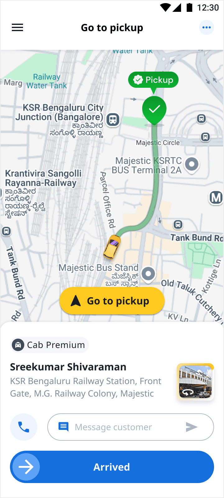
Integrating an Image View within the Pickup Screen helped drivers visually identify exact pickup points instead of relying solely on abstract map pins. It bridged the gap between digital navigation and real-world context, reducing confusion and search time. This visual clarity led to faster, more accurate pickups and improved driver confidence at busy transit hubs.
Pickup Screen
Chat & Call ingress
The chat and call customer feature was bought outside to make quick contact if required
Street view ingress
Drivers can now see this card which will lead to the google street view
Pickup marker
The pickup marker will give an idea about the distance to measure
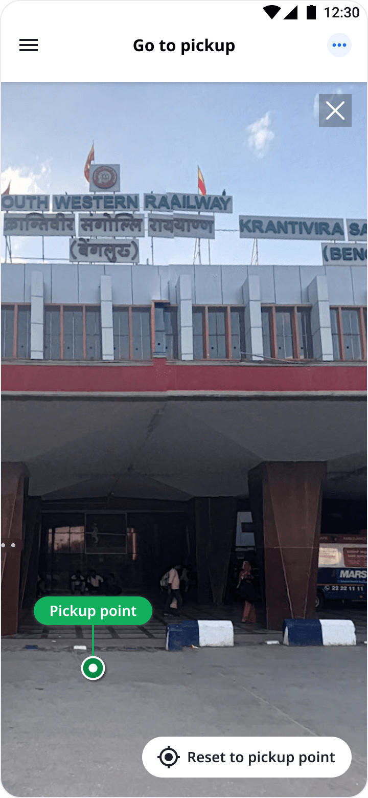
Street View of the pick up spot
The Pickup Screen first attempts to load a Street View of the exact pickup spot, showing a 360° real-world image with a highlighted marker. If Street View isn’t available, the app automatically switches to a static Image View — a cached photo of the location with the same visual cues — ensuring drivers always have a reliable visual reference regardless of connectivity or data availability.
Street View
The Street View displays a highlighted pickup marker, helping drivers instantly identify the exact pickup spot.
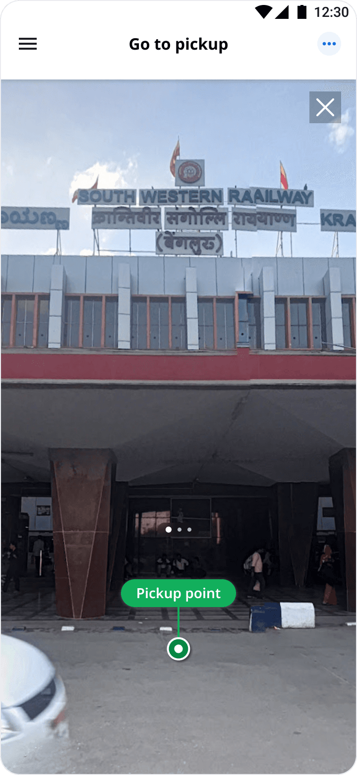
When the view is moved
When the view is moved, a “Reset to Pickup Point” option appears, allowing drivers to quickly return to the original pickup marker.
🧪 User Testing Expanded the Problem
Testing the prototype with drivers uncovered two important gaps that weren’t visible during ideation.
"What happens while the captain is still navigating?"
"What happens when the customer isn't standing at the original pickup point?"
Multiple Drivers
Although the Pickup screen improved confidence after arrival, drivers still experienced uncertainty during navigation and struggled whenever customers moved away from the pickup marker.
Rather than treating these as edge cases, I expanded the scope of the project to solve the entire pickup journey.
Extending the Experience Across the Journey
To address these gaps, I integrated Street View into navigation itself. As drivers approached the destination, the navigation marker transformed into a visual confirmation point, allowing them to preview the exact pickup location without leaving navigation.
This ensured confidence wasn’t limited to arrival—it became part of the journey itself.
Navigation Screen
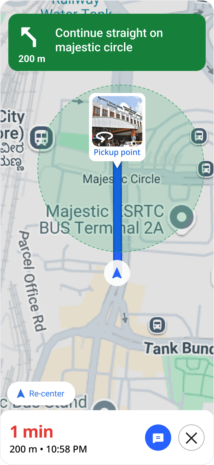
Location marker with
street view card
The card will lead to the street view when the driver is nearing the location
Chat ingress
Chat ingress on the navigation screen to check customer messages or driver can send if required
Improving the Rider–Captain Handshake
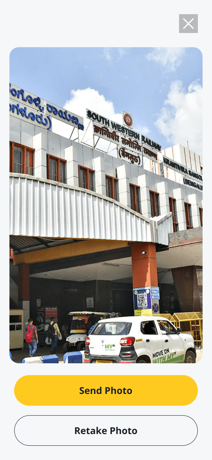
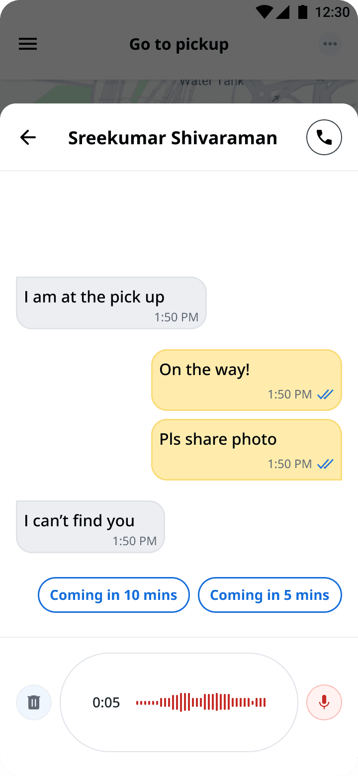
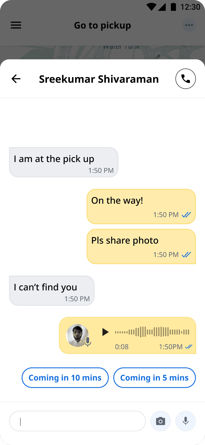
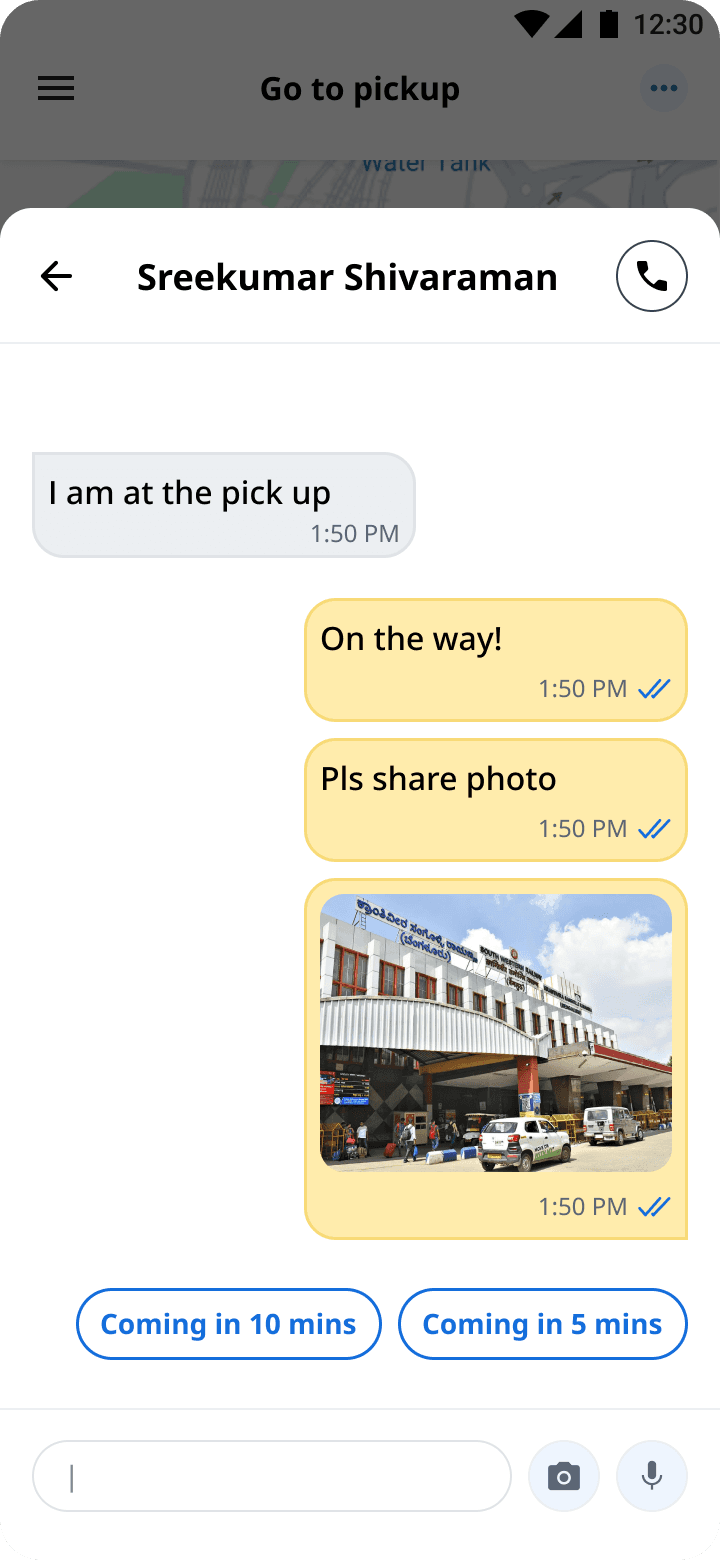
Research showed that even with visual navigation, successful pickups depended on effective communication whenever riders changed location. To reduce ambiguity, I redesigned the communication experience by introducing photo sharing and voice messaging directly inside chat.
These additions allowed drivers and customers to exchange visual and contextual information instantly, reducing unnecessary calls while improving coordination in crowded environments.
Photo capability
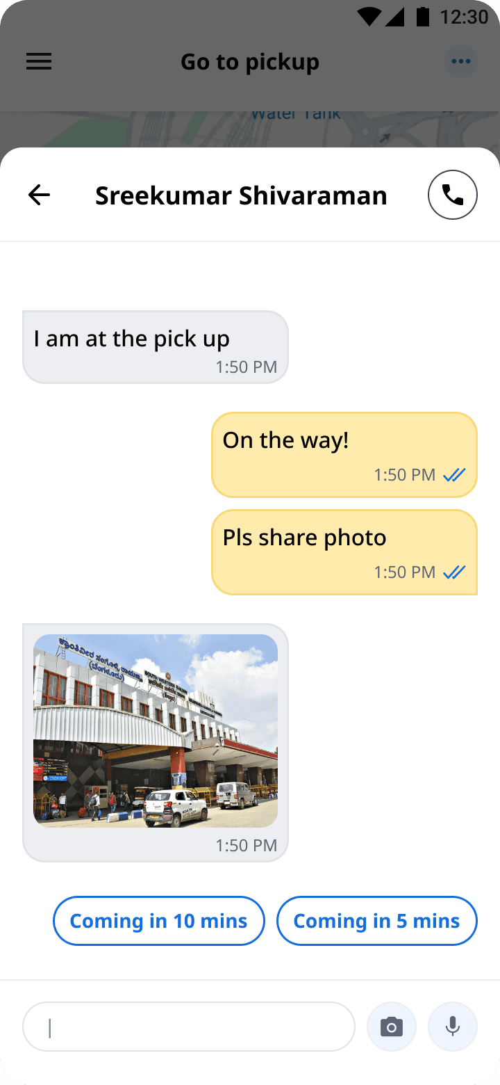
Camera integration
Recording voice
Voice message
All screens
Here are the screens that I designed as part of this initiative.

Challenges
🧩 Thinking Beyond My Product
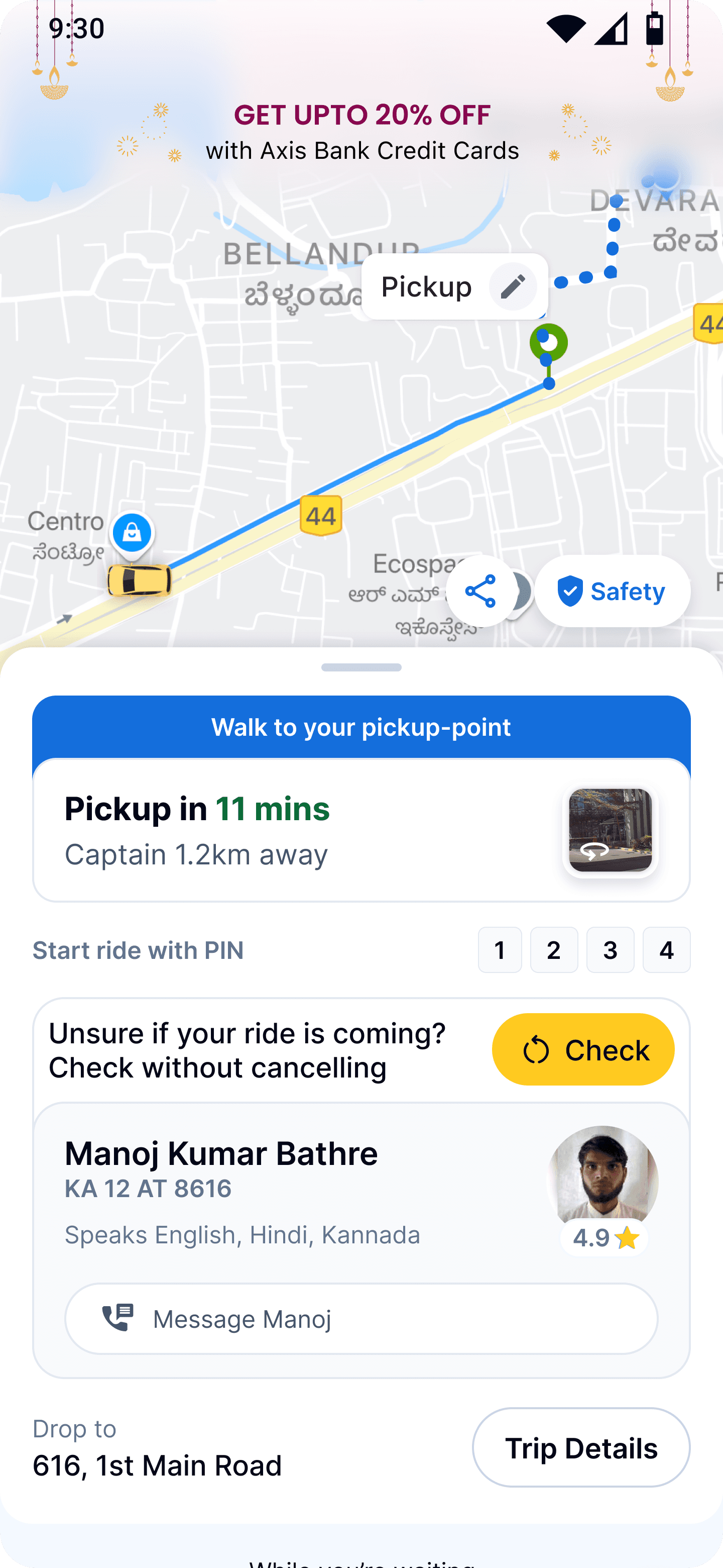
While working on the captain experience, I realised one important limitation. Improving only one side of the marketplace wouldn’t completely solve pickup accuracy. Customers were still selecting pickup locations without seeing the same visual context available to drivers. Instead of treating this as another team’s responsibility, I approached the Customer App team with the same research, business case and vision.
After aligning stakeholders across both products, we included the Visual Pickup experience in their roadmap as well, creating a shared understanding of pickup locations for both customers and drivers. This transformed the initiative from a captain feature into a marketplace capability that improved successful order fulfilment across the platform.
Customer App
Driver App
⚙️ Solving Engineering Constraints
One of the biggest technical challenges wasn’t designing Street View—it was ensuring the experience remained reliable across India. Street View coverage was inconsistent, creating a risk that many drivers would encounter empty states.
Working closely with Engineering and Maps teams, I proposed a layered fallback strategy.
If Street View was available, show an interactive Street View.
If unavailable, automatically switch to a cached location image.
If no image existed, Operations teams captured and uploaded reference images for frequently used pickup locations.
This approach ensured drivers always received visual context while keeping implementation practical and scalable.

Street view


Image view

Ops agent

Image View
Impact & Result
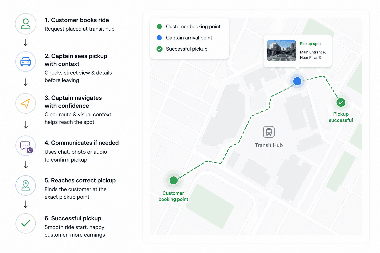
🌟 Key outcomes on Qualitative testing
9 out of 10 drivers successfully identified the correct pickup spot without external help.
7 drivers mentioned the street image gave immediate clarity about where to stop.
3 drivers operating in areas without Street View said the static photo fallback still provided enough visual context.
100% of participants said they would prefer this new view for crowded locations.
🚀 Shipping with Confidence
Given the operational impact, I recommended a phased rollout instead of a nationwide launch.
We launched first in Hyderabad and Bengaluru, where transit complexity was highest, monitored adoption, behavioural changes and marketplace metrics, and iterated before expanding across additional cities.
The phased rollout reduced technical risk while giving stakeholders confidence to scale the initiative nationally.


Metric
Before
After
Improvement
Average pickup time at transit hubs
12.5 mins
7 mins
44%
Cancellation rate at transit hubs
23%
11%
52.2%
Customer complaints (can't find driver)
340/month
89/month
73.8% reduction
🧠 Reflection
This project fundamentally changed how I think about product leadership.
The biggest achievement wasn’t introducing Street View.
It was identifying a problem before anyone asked for it, validating it through research and business data, aligning multiple organizations around a shared vision, and expanding a single feature into a system-level capability rather than a transit-specific solution.
"The most valuable design work often starts before anyone asks for it."
View projects from Flipkart


Designing a video app
One of my first UX project where I majorly worked on the widgets and user interface
Reducing the bounce rate
An analysis of how I mitigated the bounce rate by creating a fully new user experience
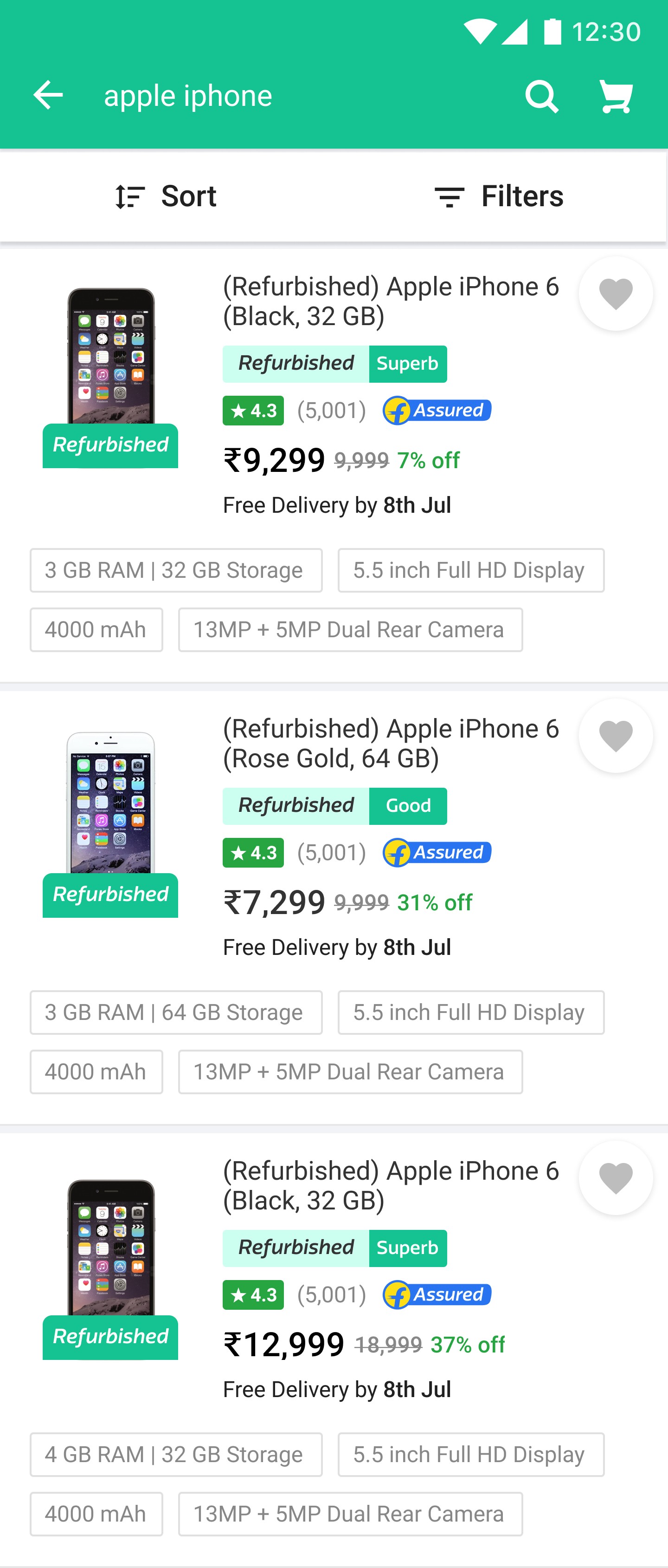

Reducing the returns rate
A project that provided significant insights into user perceptions of refurbished items